Atlas of Antonio Millo
(1,000€ - 3,000€)
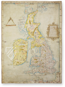
The Venetian cartographer and seafarer Antonio Millo, active inter alia as the chief navigator of the Venetian Fleet, made both of these precious maps in the 1580’s. They present the worldview of his exciting epoch, which was constantly in flux, in large-format depictions. Aside from their historical content, the valuable maps of the Mediterranean region and the entirety of the world as it was known then are true treasures of cartography!
Atlas of Antonio Millo
In the Biblioteca Nazionale Centrale Vittorio Emanuele II in Rome, two precious works of Italian cartography are stored under the shelf marks cart. naut. 2 and cart. naut. 6/1–2. They were not only helpful and indispensable aids for seafaring, which was flourishing at the time of the maps’ creation with the 16th century’s great voyages of exploration. Furthermore, the navigational maps – truly precious and artful products of cartographers – were considered to be status symbols, which bear witness to knowledge of the entire world.
A Greek in Venice
The creator of the cartographic works assembled here was Antonio Millo (active 1557–1590), a seafarer and cartographer. Millo, born on the Greek island of Milos, lived in Venice where he was inter alia the chief navigator of the Venetian Fleet. Additionally, he created numerous famous maps, which are stored today in collections across the world. The two maps presented here are precious artifacts, gorgeously colored and even adorned with individual gold elements.
Europe, Africa, Asia…
The Mediterranean stands at the center of the first map by Antonio Millo. Numerous annotations line the entire coast from Europe over Africa to the Near East. Nevertheless, the map takes more than just the Mediterranean into consideration: the Atlantic coast is also illustrated up to the British Isles in addition to the Black Sea and part of the Red Sea. Alongside the escutcheons of France, Spain, and Venice – with the Lion of San Marco – six wind roses make up the colorful pictorial adornment.
A Picture of the World ca. 1580
The world map by Antonio Millo is every bit its equal. Under the title The Earthly Planisphere, the new discoveries of recent years are taken into account. Thus, alongside Europe, Africa, and Asia, North and South America are depicted – called New Spain and New Peru here. Six wind roses and eight cherub heads in the directions of the wind make up the elegant artistic adornment of the map.
Codicology
- Alternative Titles
- Atlas of Antonio Millo
Antonio Millo, Planisfero
Antonio Millo, Bacino del Mediterraneo - Type
- Map on parchment
- Size / Format
- 23 maps / 102.0 × 71.0 cm
- Origin
- Italy
- Date
- 1582–1584
- Epochs
- Style
- Genre
- Language
- Script
- Square capitals
- Illustrations
- 12 navigational maps, 10 geographical maps and 1 world map
- Content
- 12 nautical and 11 topographic maps
- Artist / School
- Antonio Millo
#1 Antonio Millo, Planisfero
Language: Italian
(1,000€ - 3,000€)
#2 Antonio Millo, Bacino del Mediterraneo
Language: Italian
(1,000€ - 3,000€)
- Treatises / Secular Books
- Apocalypses / Beatus
- Astronomy / Astrology
- Bestiaries
- Bibles / Gospels
- Chronicles / History / Law
- Geography / Maps
- Saints' Lives
- Islam / Oriental
- Judaism / Hebrew
- Single Leaf Collections
- Leonardo da Vinci
- Literature / Poetry
- Liturgical Manuscripts
- Medicine / Botany / Alchemy
- Music
- Mythology / Prophecies
- Psalters
- Other Religious Books
- Games / Hunting
- Private Devotion Books
- Other Genres
- Afghanistan
- Armenia
- Austria
- Belgium
- Colombia
- Croatia
- Czech Republic
- Denmark
- Egypt
- Ethiopia
- France
- Germany
- Hungary
- India
- Iran
- Iraq
- Israel
- Italy
- Japan
- Luxembourg
- Mexico
- Morocco
- Netherlands
- Peru
- Poland
- Portugal
- Russia
- Serbia
- Spain
- Sri Lanka
- Sweden
- Switzerland
- Syria
- Turkey
- Ukraine
- United Kingdom
- United States
- Uzbekistan
- Aboca Museum
- Ajuntament de Valencia
- Akademie Verlag
- Akademische Druck- u. Verlagsanstalt (ADEVA)
- Aldo Ausilio Editore - Bottega d’Erasmo
- Alecto Historical Editions
- Alkuin Verlag
- Almqvist & Wiksell
- Amilcare Pizzi
- Andreas & Andreas Verlagsbuchhandlung
- Archa 90
- Archiv Verlag
- Archivi Edizioni
- Arnold Verlag
- ARS
- Ars Magna
- ArtCodex
- AyN Ediciones
- Azimuth Editions
- Badenia Verlag
- Bärenreiter-Verlag
- Belser Verlag
- Belser Verlag / WK Wertkontor
- Benziger Verlag
- Bernardinum Wydawnictwo
- BiblioGemma
- Biblioteca Apostolica Vaticana (Vaticanstadt, Vaticanstadt)
- Bibliotheca Palatina Faksimile Verlag
- Bibliotheca Rara
- Boydell & Brewer
- Bramante Edizioni
- Brepols Publishers
- British Library
- C. Weckesser
- Caixa Catalunya
- Canesi
- CAPSA, Ars Scriptoria
- Caratzas Brothers, Publishers
- Carus Verlag
- Circulo Cientifico
- Club Bibliófilo Versol
- Club du Livre
- CM Editores
- Collegium Graphicum
- Collezione Apocrifa Da Vinci
- Comissão Nacional para as Comemorações dos Descobrimentos Portugueses
- Coron Verlag
- Corvina
- CTHS
- D. S. Brewer
- De Agostini/UTET
- De Schutter
- Deuschle & Stemmle
- Deutscher Verlag für Kunstwissenschaft
- DIAMM
- Droz
- E. Schreiber Graphische Kunstanstalten
- Ediciones Boreal
- Ediciones Grial
- Ediclube
- Edições Inapa
- Edilan
- Editalia
- Edition Georg Popp
- Edition Leipzig
- Edition Libri Illustri
- Editiones Reales Sitios S. L.
- Éditions de l'Oiseau Lyre
- Editions Medicina Rara
- Editorial Casariego
- Editorial Mintzoa
- Editrice Antenore
- Editrice Velar
- Edizioni Edison
- Egeria, S.L.
- Eikon Editores
- Electa
- Enciclopèdia Catalana
- Eos-Verlag
- Ephesus Publishing
- Eugrammia Press
- Extraordinary Editions
- Fackelverlag
- Facsimila Art & Edition
- Facsimile Editions Ltd.
- Facsimilia Art & Edition Ebert KG
- Faksimile Verlag
- Feuermann Verlag
- Folger Shakespeare Library
- Franco Cosimo Panini Editore
- Friedrich Wittig Verlag
- Fundación Hullera Vasco-Leonesa
- G. Braziller
- Gabriele Mazzotta Editore
- Gebr. Mann Verlag
- Gesellschaft für graphische Industrie
- Getty Research Institute
- Giovanni Domenico de Rossi
- Giunti Editore
- Graffiti
- Grafica European Center of Fine Arts
- Guido Pressler
- Guillermo Blazquez
- H. N. Abrams
- Harrassowitz
- Helikon
- Hendrickson Publishers
- Henning Oppermann
- Herder Verlag
- Hes & De Graaf Publishers
- Hoepli
- Hortus Deliciarum
- Houghton Library
- Hugo Schmidt Verlag
- Idion Verlag
- Il Bulino, edizioni d'arte
- ILte
- Imago
- Insel Verlag
- Instituto de Estudios Altoaragoneses
- Instituto Nacional de Antropología e Historia
- Istituto dell'Enciclopedia Italiana - Treccani
- Istituto Ellenico di Studi Bizantini e Postbizantini
- Istituto Geografico De Agostini
- Istituto Poligrafico e Zecca dello Stato
- Italarte Art Establishments
- J. Thorbecke
- Jan Thorbecke Verlag
- Johnson Reprint Corporation
- Jugoslavija
- Karl W. Hiersemann
- Kasper Straube
- Kaydeda Ediciones
- Konrad Kölbl Verlag
- Kurt Wolff Verlag
- La Liberia dello Stato
- La Linea Editrice
- La Meta Editore
- Lambert Schneider
- Landeskreditbank Baden-Württemberg
- Leo S. Olschki
- Les Incunables
- Library of Congress
- Libreria Musicale Italiana
- Lichtdruck
- Lito Immagine Editore
- Lumen Artis
- Lund Humphries
- M. Moleiro Editor
- Maison des Sciences de l'homme et de la société de Poitiers
- Manuscriptum
- Maruzen-Yushodo Co. Ltd.
- MASA
- McGraw-Hill
- Militos
- Millennium Liber
- Müller & Schindler
- National Library of Wales
- Neri Pozza
- Nova Charta
- Oceanum Verlag
- Odeon
- Orbis Mediaevalis
- Orbis Pictus
- Österreichische Staatsdruckerei
- Oxford University Press
- Pageant Books
- Parzellers Buchverlag
- Patrimonio Ediciones
- Pattloch Verlag
- PIAF
- Pieper Verlag
- Plon-Nourrit et cie
- Prestel Verlag
- Princeton University Press
- Prisma Verlag
- Priuli & Verlucca, editori
- Pro Sport Verlag
- Propyläen Verlag
- Pytheas Books
- Quaternio Verlag Luzern
- Reales Sitios
- Recht-Verlag
- Reichert Verlag
- Reichsdruckerei
- Riehn & Reusch
- Roberto Vattori Editore
- Rosenkilde and Bagger
- Roxburghe Club
- Salerno Editrice
- Sarajevo Svjetlost
- Schöck ArtPrint Kft.
- Scolar Press
- Scrinium
- Scripta Maneant
- Scriptorium
- Siloé, arte y bibliofilia
- SISMEL - Edizioni del Galluzzo
- Sociedad Mexicana de Antropología
- Sorli Ediciones
- Stainer and Bell
- Styria Verlag
- Sumptibus Pragopress
- Szegedi Tudomànyegyetem
- Taberna Libraria
- Tarshish Books
- Taschen
- Tempus Libri
- Testimonio Compañía Editorial
- Thames and Hudson
- The Clear Vue Publishing Partnership Limited
- The Facsimile Codex
- The Folio Society
- The Marquess of Normanby
- The Richard III and Yorkist History Trust
- Tip.Le.Co
- TouchArt
- TREC Publishing House
- TRI Publishing Co.
- Trident Editore
- Typis Regiae Officinae Polygraphicae
- Universidad de Granada
- University of California Press
- University of Chicago Press
- Urs Graf
- Vallecchi
- Van Wijnen
- VCH, Acta Humaniora
- VDI Verlag
- Verlag für Regionalgeschichte
- Verlag Styria
- Vicent Garcia Editores
- W. Turnowsky
- Wiener Mechitharisten-Congregation (Wien, Österreich)
- Wissenschaftliche Buchgesellschaft
- Xuntanza Editorial
- Zollikofer AG


